
ডিজিটাল ভূমি জরিপে ড্রোনের ব্যবহার । Use of Drones in Digital land survey ।…
This is the Daily Digest from Land Surveyors United Community. Share your Surveying Life with us!

@landsurveyorsu • December 17, 2022, 2:12 am
Lᴀɴᴅ Sᴜʀᴠᴇʏᴏʀs Uɴɪᴛᴇᴅ ✊ Gʟᴏʙᴀʟ Sᴜʀᴠᴇʏɪɴɢ Cᴏᴍᴍᴜɴɪᴛʏ @LandSurveyorsU
ডিজিটাল ভূমি জরিপে ড্রোনের ব্যবহার । Use of Drones in Digital land survey । SSTC.. - learn.landsurveyorsunited.com/336803/dijital…

@landsurveyorsu • December 16, 2022, 10:11 pm
Lᴀɴᴅ Sᴜʀᴠᴇʏᴏʀs Uɴɪᴛᴇᴅ ✊ Gʟᴏʙᴀʟ Sᴜʀᴠᴇʏɪɴɢ Cᴏᴍᴍᴜɴɪᴛʏ @LandSurveyorsU
Closing Corners and Getting it done in the desert! https://t.co/xC3H82iMFo

@landsurveyorsu • December 11, 2022, 7:40 pm
Lᴀɴᴅ Sᴜʀᴠᴇʏᴏʀs Uɴɪᴛᴇᴅ ✊ Gʟᴏʙᴀʟ Sᴜʀᴠᴇʏɪɴɢ Cᴏᴍᴍᴜɴɪᴛʏ @LandSurveyorsU
My back yard is a challenging RTK environment. People sometimes ask me if it will do RTK work when there are a few trees. Here in…
@landsurveyorsu • December 11, 2022, 6:11 pm
Lᴀɴᴅ Sᴜʀᴠᴇʏᴏʀs Uɴɪᴛᴇᴅ ✊ Gʟᴏʙᴀʟ Sᴜʀᴠᴇʏɪɴɢ Cᴏᴍᴍᴜɴɪᴛʏ @LandSurveyorsU
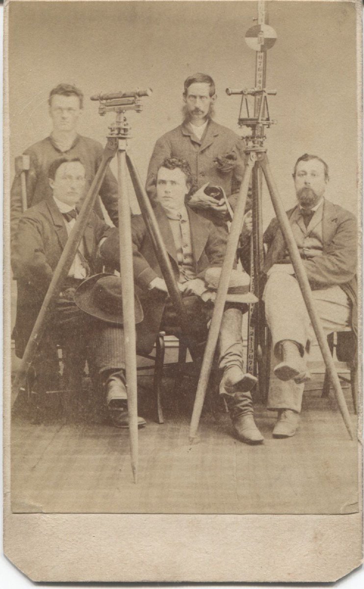
1875 Celebrate #surveying History... join the Surveying History Hub and go back in time landsurveyorsunited.com/hubs/surveying…
@landsurveyorsu • December 11, 2022, 4:55 pm
Lᴀɴᴅ Sᴜʀᴠᴇʏᴏʀs Uɴɪᴛᴇᴅ ✊ Gʟᴏʙᴀʟ Sᴜʀᴠᴇʏɪɴɢ Cᴏᴍᴍᴜɴɪᴛʏ @LandSurveyorsU
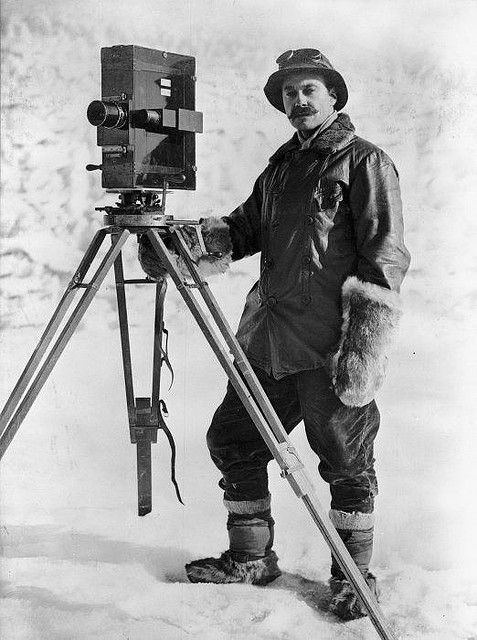
Anyone know what to call this instrument? Anyone know what to call this instrument?#surveyinghistory - typefully.com/LandSurveyorsU……
Follow Us on Twitter @landsurveyorsU
Follow us on Facebook @landsurveyorsunited
ডিজিটাল ভূমি জরিপে ড্রোনের ব্যবহার । Use of Drones in Digital land survey ।…
![ডিজিটাল ভূমি জরিপে ড্রোনের ব্যবহার । Use of Drones in Digital land survey ।…]() Reviewed by Land Surveyors United
on
12/17/2022 07:01:00 PM
Rating:
Reviewed by Land Surveyors United
on
12/17/2022 07:01:00 PM
Rating:


No comments