
Elevation Certificate An elevation certificate is a document prepared by a…
This is the Daily Digest from Land Surveyors United Community. Share your Surveying Life with us!

@landsurveyorsu • August 5, 2024, 12:35 pm
LAND SURVEYORS UNITED ✊ ɢʟᴏʙᴀʟ sᴜʀᴠᴇʏɪɴɢ ᴄᴏᴍᴍᴜɴɪᴛʏ @LandSurveyorsU
Elevation Certificate An elevation certificate is a document prepared by a qualified engineer / surveyor which provides…
@landsurveyorsu • August 2, 2024, 7:01 pm
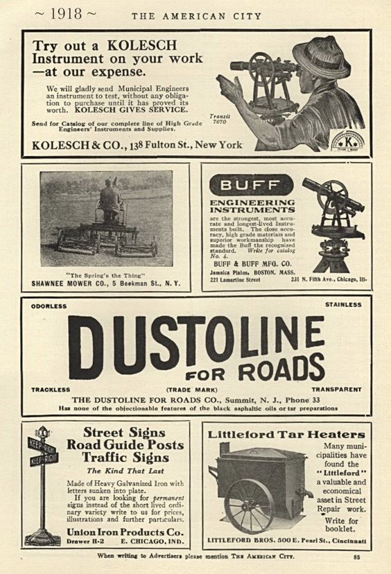
LAND SURVEYORS UNITED ✊ ɢʟᴏʙᴀʟ sᴜʀᴠᴇʏɪɴɢ ᴄᴏᴍᴍᴜɴɪᴛʏ @LandSurveyorsU
1918 #surveyinghistory https://t.co/PFc6v2jYSQ

@landsurveyorsu • August 2, 2024, 12:17 pm
LAND SURVEYORS UNITED ✊ ɢʟᴏʙᴀʟ sᴜʀᴠᴇʏɪɴɢ ᴄᴏᴍᴍᴜɴɪᴛʏ @LandSurveyorsU
Now You Can Post to Any Local Surveyor Chapter from an Interactive Map Today we are introducing the first part of a massive…
Follow Us on Twitter @landsurveyorsU
Follow us on Facebook @landsurveyorsunited
Elevation Certificate An elevation certificate is a document prepared by a…
![Elevation Certificate An elevation certificate is a document prepared by a…]() Reviewed by Land Surveyors United
on
8/07/2024 08:00:00 PM
Rating:
Reviewed by Land Surveyors United
on
8/07/2024 08:00:00 PM
Rating:


No comments