
Just taking my break boss. https://t.co/VFnjjRU2fy
This is the Daily Digest from Land Surveyors United Community. Share your Surveying Life with us!

@landsurveyorsu • June 30, 2023, 8:24 pm
ʟᴀɴᴅ sᴜʀᴠᴇʏᴏʀs ᴜɴɪᴛᴇᴅ ✊ ɢʟᴏʙᴀʟ sᴜʀᴠᴇʏɪɴɢ ᴄᴏᴍᴍᴜɴɪᴛʏ @LandSurveyorsU
Just taking my break boss. https://t.co/VFnjjRU2fy

@landsurveyorsu • June 28, 2023, 6:20 pm
ʟᴀɴᴅ sᴜʀᴠᴇʏᴏʀs ᴜɴɪᴛᴇᴅ ✊ ɢʟᴏʙᴀʟ sᴜʀᴠᴇʏɪɴɢ ᴄᴏᴍᴍᴜɴɪᴛʏ @LandSurveyorsU
Someone grab that theodolite https://t.co/Qd61Ku88zj

@landsurveyorsu • June 27, 2023, 11:48 am
ʟᴀɴᴅ sᴜʀᴠᴇʏᴏʀs ᴜɴɪᴛᴇᴅ ✊ ɢʟᴏʙᴀʟ sᴜʀᴠᴇʏɪɴɢ ᴄᴏᴍᴍᴜɴɪᴛʏ @LandSurveyorsU
Drone Aerial Mapping Land surveyors have always produced drawings that show the property as if you were looking at it from above the…

@landsurveyorsu • June 26, 2023, 6:52 pm
ʟᴀɴᴅ sᴜʀᴠᴇʏᴏʀs ᴜɴɪᴛᴇᴅ ✊ ɢʟᴏʙᴀʟ sᴜʀᴠᴇʏɪɴɢ ᴄᴏᴍᴍᴜɴɪᴛʏ @LandSurveyorsU
1911-1912 Canada Minister Of The-Interior Official Land Surveyor Record #surveyinghistory #Canada https://t.co/AkPgFYhJmu
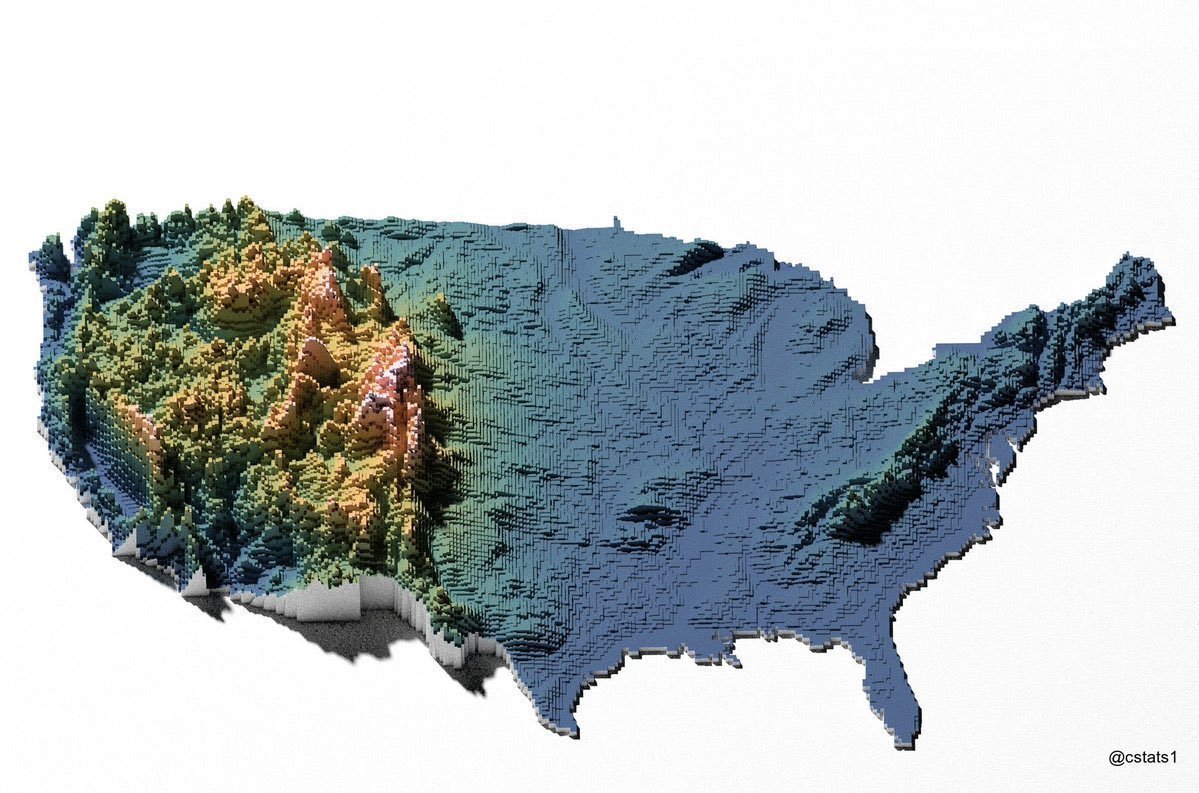
@landsurveyorsu • June 27, 2023, 1:42 pm
Epic Maps 🗺️ @Locati0ns
RT by: ʟᴀɴᴅ sᴜʀᴠᴇʏᴏʀs ᴜɴɪᴛᴇᴅ ✊ ɢʟᴏʙᴀʟ sᴜʀᴠᴇʏɪɴɢ ᴄᴏᴍᴍᴜɴɪᴛʏ @LandSurveyorsU
RT @Locati0ns: Topographic map of the US https://t.co/zz5ttnoiqv
Follow Us on Twitter @landsurveyorsU
Follow us on Facebook @landsurveyorsunited
Just taking my break boss. https://t.co/VFnjjRU2fy
![Just taking my break boss. https://t.co/VFnjjRU2fy]() Reviewed by Land Surveyors United
on
7/01/2023 07:54:00 PM
Rating:
Reviewed by Land Surveyors United
on
7/01/2023 07:54:00 PM
Rating:


No comments